
The view across Anglesea

Near Aireys Inlet

The Great Ocen Road was constructed by veterans of the First World War and is now a memorial to those who did not return. This gate, just outside Airey's Inlet, is a memorial to those who fell and the statue honours those who constructed the road.
This link will provide further information:


Looking Towards Lorne

Lorne


One of the many rivers that meet the ocean on the road

Views along th coast after Lorne


Below is the Sailors Grave near Lorne. The WB Godfrey was wrecked on the rocks below. No lives were lost, but there were deaths during the Salvage attempt. These were buried close to the wreck site. During the construction of the Great Ocean Road, the bodies were found, but they were left where they were, and the grave was placed beside the road as a memorial.
More information is available from the following links:


All that remains of the WB Godfrey is an anchor and a windlass which can be seen at low tide

The view from the lookout at the wreck site

The township of Wye River

The column of smoke that can be seen behind the township is a controlled burn undertaken to reduce the risk of damage during a bushfire - a case of using fire to control fire!

At Apollo Bay

I stayed here for five days. More information about Apollo Bay can be found here:
Around Cape Otway and the Otway Ranges

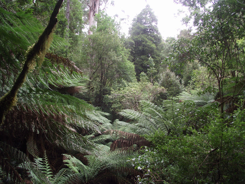
On the way to Cape Otway at a restt area called Mait's Rest there is a short Rainforest Walk which passes through Myrtle Beac, Tree Ferns and Mountain Ash trees. The Myrtle Beech is an acient tree and the example below is probably over 300 years old and started lifr growing over the remains of a previous earlier tree.
Try the following link:


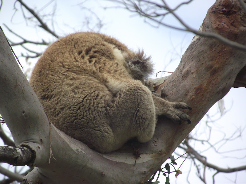
Some Koala's near Cape Otway


The Telgraph Keepers House at the Cape Otway Light Station

One of the keepers cottages

Two views of the lightouse


In the Aboriginal Heritage area in the Light Station grounds


An example of an Aboriginal Shelter
More information can be found at the links below:

The bridge over the Aire River near the river mouth
Looking towards the Mouth of the Aire River near Hordern Vale

Looking upriver at the same spot

Some views of Johanna Beach - a favoured surfing venue and can be used for the Bell's Beach Championship if the surf there does not meet standards.

Looking toward Moonlight Head from Johanna Beach

Two views of the Hpetoun Falls near Beech Forest in the Great Otway National Park on the Aire River


On the rainforest walk to the Triplet Falls - more Mountain Ash, Myrtle Beach and Tree Ferns


Two views of the Triplet Falls


An old sawmill site near the Triplet Falls - A log tramway cart

Two views of an old Boiler

Some Interesting Links:

The view from The Gables Lookout near Moonlight Head

A Bottlebrush plant beside the walking track

A view of Wreck Beach near the gables lookout
Here is a link with more information abou the wrecks

Some views of the 12 Apostles near Port Campbell. A few years ago one of the Apostles crumbled away.


The Loch Ard Gorge near Port Campbell and the site of the wreck of the Loch Ard on Mutton Bird Island. There were only two survivors who manged to get to the beach at the head of the gorge.
More information is available from:


Mutton Bird Island

Port Campbell

London Bridge between Port Campbell and Peterborough. When I fist visited this spot the island was stiull connected to thge mainland by an arch. a few years ago the Arch collapsed trapping some visitors on the Island!
More Information herehttp://thomasjupe.com/2011/02/27/the-great-ocean-road-london-bridge-port-campbell-national-park/
No comments:
Post a Comment